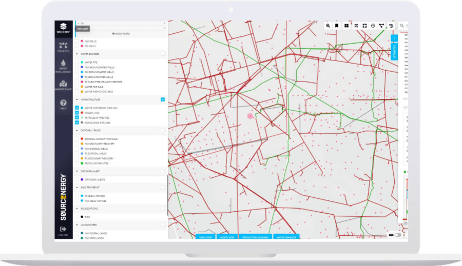
Sourcenergy GIS™
All the standard oil, gas, disposal, water and surface data you need, plus GIS tools to upload, plan, manage and share your projects in their complete, current, accurate upstream energy context.
Request demoSourcenergy GIS™ provides all the standard oil, gas, disposal, water and surface data you need, plus GIS tools to upload, plan, manage and share your projects in their complete, current, accurate upstream energy context.
- Upload custom basemaps of your facilities and infrastructure, then monitor and act on daily and weekly changes in their context, such as new drilling permits, changes in crude production, rig movement, injection pressures, or near-daily satellite imagery update.
- Stop relying on stale, misleading images in Google Earth that don’t reveal current activity on the ground.
- Oilfield Alerts: Get daily, automated email alerts whenever any subset of upstream activities that you have defined occurs in the exact areas of interest (AOIs) that you define.
- To gain the full power of Sourcenergy GIS™ add on Sourcenergy’s other proprietary energy and water data analytics packages.

| Sourcenergy GIS™ includes all of the standard oil and gas, disposal and injection, groundwater and surface data and GIS tools, including: |
|---|
| Oil & Gas Data – Permits, Completions, Production, Rigs |
| Disposal & Injection Data – Volumes, Pressures, Depths, Facilities |
| Groundwater Data – FracFocus, Permits, Driller Reports, Basins, Aquifers |
| Geographic (GIS) Data – Satellite Basemap, Surface Owner Parcel Map, PLSS, Power Grid |
| GIS Tools – AOI Tools, Custom Alerts, ROW & Facility Placement, KML, SHP uploads |
Request a free demo
Talk
Call us to learn how we can help you with your upstream energy and water intelligence needs